 |
|
|

|
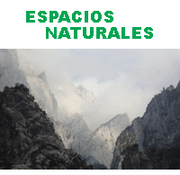
Red OSPAR de áreas marinas protegidas
La Convención para la
Protección del Medio Ambiente Marino del
Atlántico del Nordeste o Convención OSPAR es
el instrumento legislativo
que regula la protección medioambiental en la zona Nordeste del Océano
Atlántico. El convenio
OSPAR, surgió en París en septiembre de 1992
(aunque no entró en vigor hasta 1998), fruto de las conclusiones de dos
convenios anteriores: el convenio de Oslo (1972) para la prevención de
la contaminación marina provocada por vertidos desde buques y
aeronaves, y el convenio de París (1974) para la prevención de la
contaminación marina de origen terrestre (magrama.gob.es, 2012).
El organismo que regula el cumplimiento de la convención OSPAR, es la
Comisión
OSPAR, constituida por representantes de los 15 países que
forman parte de la comisión y por miembros de la Unión Europea.
La comisión OSPAR además de velar por el medio-ambiente de la región ha
designado una lista de espacios naturales de especial protección, las
Áreas Marinas Protegidas de la Comisión OSPAR (Marine Protected Areas
of the OSPAR Commission), un total de 552 espacios de 11 países
(ospar.org,2020):
|
Áreas de alta mar (aguas interna-
cionales) |
Monte
submarino Altair y Antialtair, Charlie-Gibbs Norte y Sur, Monte
submarino Josephine , Norte del mar de las Azores y Complejo del Monte
submarino Milne. |
| Alemania |
Borkum-Riffgrund,
Doggerbank, Niedersächsisches Wattenmeer, Área de protección S-H
Seabird, PN S-H mar de las Wadden y Sylt.Aussenr.-Oestl.Dt.Bucht. |
| Bélgica |
Vlaamse
Banken (SBZ1 y SBZ2), y SBZ3. |
| Dinamarca |
Agger Tange,
Nissum Bredning, Skibsted Fjord og Agerø; østlige del Ålborg Bugt;
Ålborg Bugt, Randers Fjord og Mariager Fjord; Anholt og havet nord for;
Ebbeløkkerev; Farvandet nord for Anholt; Gilleleje Flak og Tragten;
Gule Rev; Havet og kysten mellem Hundested og Rørvig; Havet omkring
Nordre Rønner; Herthas Flak; Hesselø med omliggende stenrev;
Hirsholmene, havet vest herfor og Ellinge; Jyske Rev, Lillefiskerbanke;
Kims Top og den Kinesiske Mur; Knudegrund; Kobberhage kystarealer;
sydlige del Læsø; Læsø Trindel og Tønneberg Banke; Løgstør Bredning,
Vejlerne og Bulbjerg; Lønstrup Rødgrund; Lysegrund; Nissum Fjord;
Ringkøbing Fjord og; Nymindestrømmen; Sandbanker ud for Thorsminde;
Sandbanker ud for Thyborøn; Schultz og Hastens Grund samt Briseis Flak;
Skagens Gren og Skagerrak; Store Middelgrund; Store Rev; Strandenge på
Læsø og havet syd herfor; Sydlige Nordsø; Thyborøn Stenvolde y
Vadehavet med Ribe Å, Tved Å og Varde Å vest for Varde. |
| España |
Ver Red
OSPAR de España. |
| Francia |
Abers -
côtes des Légendes, Archipel des Glénan, Au droit de l'étang
d'Hourtin-Carcans, Baie de l'Aiguillon, Baie de Morlaix, Baie de
Saint-Brieuc, Baie de Seine occidentale, Baie de Somme, Banc d'Arguin,
Bancs des Flandres, Bassin d'Arcachon et cap Ferret, Belle Ile en mer,
Côte Basque rocheuse et extension au large, Côte de granit rose -
Sept-Iles, Domaine de Beauguillot, Estuaire de la Seine, Falaise du
Bessin occidental, Golfe du Morbihan, côte ouest de Rhuys, Isla de
Groix, Iroise, Littoral cauchois, Marais de Moëze, Marais du Cotentin
et du Bessin - baie des Veys, Massif dunaire Gâvres-Quiberon et zones
humides associées, Panache de la Gironde, Pertuis charentais, Plateau
rocheux de l'île d'Yeu, Portion du littoral sableux de la côte
Aquitaine, Récifs et marais arrière-littoraux du cap Lévi à la pointe
de Saire, Roches de Penmarch, Secteur de l'île d'Yeu, Tatihou
Saint-Vaast-la-Hougue y Trégor Goëlo. |
| Irlanda |
Ballyness
Bay, Belgica Mound Province, Blasket Islands, Cummeen Strand/Drumcliff
Bay (Sligo Bay), Dundalk Bay, Galway Bay Complex, Hovland Mound
Province, Kenmare River, Kilkieran Bay and Islands, Kingstown Bay,
Malahide Estuary, Mullet/Blacksod Bay Complex, Mulroy Bay, North Dublin
Bay, North-West Porcupine Bank, Roaringwater Bay and Islands,
South-West Porcupine Bank, Tralee Bay and Magharees Peninsula, West To
Cloghane y Tramore Dunes and Backstrand. |
| Islandia |
Eldey,
Hornarfjardardjup 1 y 2, Hverastrytur i Eyjafirdi, Lónsdjúp-Papagrunn
landgrunnskantur, Reynisdjup, Rósagarður, Skaftardjup 1 y 2,
Skeiðarárdjúp y Surtsey. |
| Noruega |
Bjørnøya,
Breisunddjupet, Færder, Framvaren, Gaulosen, Iverryggen, Jærkysten, Jan
Mayen, Jomfruland, Korallen, Raet, Rødberg, Røstrevet, Saltstraumen,
Selligrunnen, Sularevet, Svalbard East, Svalbard West, Tauterryggen,
Trænarevet y Ytre Hvaler. |
| Países Bajos |
Doggerbank,
Klaverbank, Noordzeekustzone, Vlakte van de Raan y Voordelta. |
| Portugal |
Arrabida,
Berlengas, Corvo Island, D. João de Castro seamount, Faial-Pico
Channel, Formigas Bank, Lagoas de Santo Andre e Sancha, Litoral Norte,
Lucky Strike hydrothermal vent, Menez Gwen hydrothermal, Rainbow
hydrothermal, Sedlo Seamount y Sudoeste Alentejano e Costa Vicentina. |
| Reino Unido |
Ailsa
Craig, Albert Field, Alde Ore and Butley Estuaries, Alde - Ore Estuary,
Allonby Bay, Aln Estuary, Anglesey Terns / Morwenoliaid Ynys Mon, Anton
Dohrn Seamount, Ardvar and Loch a' Mhuilinn Woodlands, Ascrib, Isay and
Dunvegan, Axe Estuary, Carmarthen Bay, Cemlyn Bay, Baie ny Carrickey,
Bassurelle sandbank, Beachy Head East y West, Belfast Lough, Bembridge,
Benfleet and Southend Marshes, Berwickshire and North Northumberland
Coast, Berwick to St Mary's, Bideford to Foreland Point, Blackwater,
Crouch, Roach and Colne Estuaries, Braemar Pockmarks, Braunton Burrows,
Breydon Water, Bristol Channel Approaches / Dynesfeydd Mor Hafren,
Buchan Ness to Collieston Coast, Burry Inlet, Calf and Wart Bank, Calf
of Eday, Camel Estuary, Canna and Sanday, Cape Bank, Cape Wrath,
Cardigan Bay / Bae Ceredigion, Carlingford Lough, Carmarthen Bay and
Estuaries, Central Fladen, Chesil, the Fleet y Stennis Ledges,
Chichester and Langstone, Harbours, Clyde Sea Sill, Colne Estuary,
Copinsay, Coquet Island, Croker Carbonate Slabs, Cromarty Firth, Cromer
Shoal Chalk Beds, Crouch and Roach Estuaries, Cumbria Coast, Dart
Estuary, Darwin Mounds, Deben Estuary, Dee Estuary, Dengie, Devon Avon
Estuary, Dogger Bank, Dornoch Firth, Loch Fleet y Morrich More, Douglas
Bay, Dover to Deal, Dover to Folkestone, Drigg Coast, Dungeness, Romney
Marsh and Rye Bay, Durness, Dyfi Estuary, East Caithness Cliffs, East
Mingulay, East of Gannet, East of Haig Fras, East of Start Point, East
Rockall Bank, East Sanday Coast, Eileanan agus Sgeiran Lios mór, Erme
Estuary, Essex Estuaries, Exe Estuary, Fair Isle, Fal and Helford,
Falmouth Bay to St Austell Bay, Faray and Holm of Faray, Farne Islands,
Farnes East, Faroe-Shetland Sponge Belt, Fetlar, Fetlar to Haroldswick,
Firth of Forth Banks, Firth of Lorn, Firth of Tay, Flamborough and
Filey Coast, Flamborough Head, Flannan Isles, Folkestone Pomerania,
Foreland, Forth Islands, Foula, Foulness, Fowlsheugh, Fulmar, Fylde,
Geikie Slide and Hebridean Slope, Gibraltar Point, Glannau Aberdaron
and Ynys Enlli, Glannau Môn: Cors heli, Glen Beasdale, Goodwin Sands,
Grassholm, Greater Haig Fras, Greater Wash, Gruinart Flats, Islay, Haig
Fras, Haisborough, Hammond and Winterton, Hamford Water, Handa,
Hartland Point, Hascosay, Hatton Bank, Hatton-Rockall Basin, Helford
Estuary, Hermaness, Saxa Vord and Valla Field, Holderness Inshore y
Offshore, Hoy, Humber Estuary, Inner Bank, Inner Clyde Estuary, Inner
Dowsing, Race Bank and North Ridge, Inner Hebrides and the Minches,
Inner Moray Firth, Inverpolly, Irish Sea Front, Isle of May, Isles of
Scilly, Jersey Coast, Kenfig, Kentish Knock East, Killough Bay,
Kingmere, Kinloch and Kyleakin Hills, Langness, Larne Lough, Laxey Bay,
Les Ecrehous, Les Minquiers, Limestone Coast of South West Wales,
Lindisfarne, Little Ness, Liverpool Bay, Lizard Point, Loch Carron,
Loch Creran, Loch Laxford, Loch Moidart and Loch Shiel Woods, Loch nam
Madadh, Loch of Stenness, Loch Roag Lagoons, Lochs Duich, Long and Alsh
Reefs, Loch Sunart, Loch Sween, Lough Foyle, Luce Bay and Sands, Lundy,
Lyme Bay and Torbay, Margate and Long Sands, Markham's Triangle,
Marwick Head, Medway Estuary and Marshes, Menai Strait and Conwy Bay,
Mersey Estuary, Mersey Narrows and North Wirral Foreshore, Mingulay and
Berneray, Minsmere-Walberswick, Mòine Mhór, Monach Islands, Montrose
Basin, Moray and Nairn Coast, Moray Firth, Morecambe Bay and Duddon
Estuary, Morte Platform, Mounts Bay, Mousa, Mousa to Boddam, Mull
Oakwoods, Murlough, Newquay and The Gannel, Niarbyl Bay, North Anglesey
Marine, North Caithness Cliffs, North Channel, North Colonsay and
Western Cliffs, North-east Faroe-Shetland Channel, North East of Farnes
Deep,
Northern Cardigan Bay, North Norfolk Sandbanks and Saturn
Reef, North Rona and Sula Sgeir, North Uist Machair and Islands,
Northumberland Marine, Northumbria Coast, North-West of Jones Bank,
North-west Orkney, North West Rockall Bank, Norwegian Boundary Sediment
Plain, Noss, Noss Head, Obain Loch Euphoirt, Offshore Brighton,
Offshore Overfalls, Orford Inshore, Orfordness-Shingle Street, Otter
Estuary, Outer Ards, Outer Belfast Lough, Outer Thames Estuary, Padstow
Bay and Surrounds, Pagham Harbour, Papa Stour, Papa Westray,
Pembrokeshire Marine, Pen Llyn a`r Sarnau, Pisces Reef Complex,
Plymouth Sound and Estuaries, Pobie Bank Reef, Poole Harbour, Poole
Rocks, Port Erin Bay, Portsmouth Harbour, Purbeck Coast, Queenie
Corner, Ramsey Bay, Rathlin Island, Red Bay, Ribble and Alt Estuaries,
Rousay, Rum, Runnel Stone, Runswick Bay, Sanday, Scanner Pockmark,
Selsey Bill and the Hounds, Severn Estuary, Shell Flat and Lune Deep,
Skerries and Causeway, Skerries Bank and Surrounds, Skomer, Skokholm
and the Seas off Pembrokeshire, Sléibhtean agus Cladach Thiriodh, Small
Isles, Solan Bank Reef, Solent and Dorset Coast, Solent and Southampton
Water, Solent Maritime, Solway Firth, Sound of Arisaig, Sound of Barra,
South Arran, Southbourne Rough, South Dorset, South-East Islay
Skerries, Southern North Sea, South of Celtic Deep, South of Portland,
South of the Isles of Scilly, South Rigg, South Uist Machair and Lochs,
South West Approaches to the Bristol Channel, South West Deeps, South
Wight Maritime, St Abb`s Head to Fast Castle, Stanton Banks, Start
Point to Plymouth Sound and Eddystone, St Kilda, Stour and Orwell
Estuaries, Strangford Lough, Studland Bay, Studland to Portland, Sule
Skerry and Sule Stack, Sullom Voe, Sumburgh Head, Sunart, Swallow Sand,
Swanscombe, Tamar Estuaries Complex, Taynish and Knapdale Woods,
Tayvallich Juniper and Coast, Teesmouth and Cleveland Coast, Thames
Estuary and Marshes, Thanet Coast and Sandwich Bay, The Barra Fan and
Hebrides Terrace Seamount, The Canyons, The Dee Estuary, The Maidens,
The Manacles, The Needles, The Shiant Isles, The Swale Estuary, The
Vadills, The Wash and North Norfolk Coast, Torbay, Traeth Lafan,
Treshnish Isles, Troup, Pennan and Lion`s Heads, Turbot Bank, Tweed
Estuary, Upper Fowey and Pont Pill, Upper Loch Fyne and Loch Goil,
Upper Solway Flats and Marshes, Utopia, Waterfoot, West Coast, Western
Channel, Wester Ross, West of Copeland, West of Scotland, West of
Walney, West of Wight-Barfleur, West Shetland Shelf, West Wales Marine,
West Westray, Whitsand and Looe Bay, Wight-Barfleur Reef, Wyre and
Rousay Sounds, Wyre-Lune, Wyville Thomson Ridge, Yarmouth to Cowes y
Yell Sound Coast. |
| Suecia |
Bratten,
Fladen, Gullmarsfjorden, Havstensfjord, Kosterfjorden-Väderöfjorden,
Kungsbackafjorden, Lilla Middelgrund, Morups bank, Nordre älvs
estuarium y Stora Middelgrund och Röde bank. |
| Áreas
marinas protegidas por el Convenio OSPAR (2021). |
|

| |
 |
|
 |
|
www.biogeografia.net
|